

|
|
Quincy, Amador County Ghost Town | ||
|
You may credit or blame the ghost town of Quincy for the writer's first try at writing Amador history. That was back in 1966, when, as Jackson bureau chief for the Sacramento Bee, he wrote a full-length, modestly researched feature story about the ephemeral camp. Quincy existed somewhere 1.5 to 2 miles north of Ione within the rolling hills between Mule and Dry Creeks. Maybe, the northeasterly corner of Mule Creek State Prison may be in its vicinity. |
|
|
|
The late Paul T. Hubbard, then a Preston parole agent, introduced Logan to the mystery. Besides his vocation, Hubbard was 'an amateur archeologist and historian', and member ofthe lone Community Methodist Church. In some work - perhaps in a writing by the former Rev. Thomas Miller of that church - he had read about Quincy and decided to look into it. He wasn't the first. It seems every generation had someone who hears of Quincy, seeks the site, takes photographs, metal detects. Yet, its exact location may not yet be known. More certainly, no one knows why it disappeared in late 1855 or early 1856, and Muletown, its neighboring camp, didn't. In 1954, Amador's centennial created heightened interest in its history, including Quincy's. The then doyennes of Amador lore, the late Mary E. McCaskey and Dorothy Sargent van Thiel, corresponded widely to illuminate the county's past. That March, John Winkler, archivist for the Methodist Conference, answered a Miss McCaskey's missive. Winkler had visited Quincy a year before with Rev. Miller. "Miller," he said, "is probably the only living person who knows exactly where the town stood." How did Miller find out? From Will Haverstick, a Muletown native, who took Miller there "years ago". There was nothing on the spot, wrote Winkler, to identify the town. Later that year Rev. Miller himmself wrote van Thiel and observed that talk of a "lost Quincy' upset Haverstick. He certainly knew where it was - or thought he did. The site, then and now, is within the sprawling Arroyo Seco Rancho, allegedly a Mexican land grant. Once grant owners and their major domo weren't as strict about who entered the gate just past Mule Creek. Miller wrote van Thiel that if she wished to see Quincy, just get the "key at the Brubeck place west of Ione". Among specific instructions was this general one: you'll find Quincy "on a slope descending to Mule Creek". (Just one of many clues which latter day searchers would employ in a major search in 1992. About that anon.) |
||
|
Yet again in 1960 Miller wrote van Thiel, saying it was "3 miles from the gate (on Highway 104) to Quincy and over two miles to Muletown". Quincy then had nothing but young oaks and lay maybe a "mile west of Muletown". The writer doesn't know whether McCaskey, van Thiel or anyone followed the instructions and visited the site. |
|
|
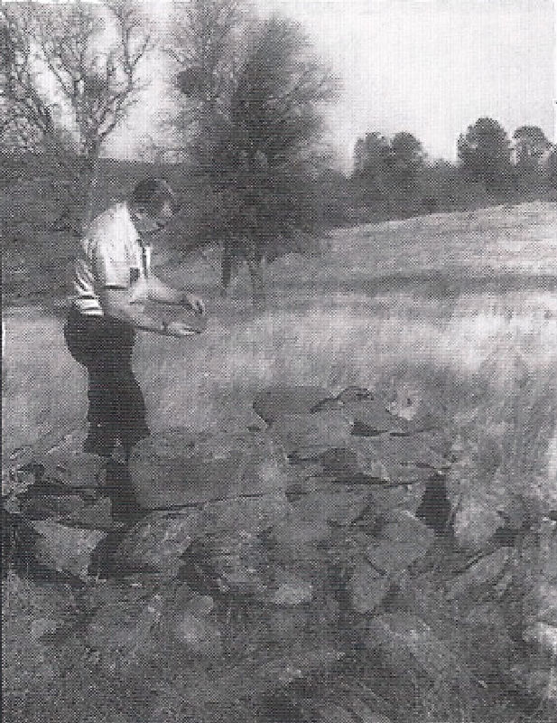
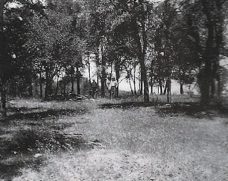
But we do know that in 1963 a large contingent from the Amador County Historical iety "went over the ground ofthe former town". So wrote the irrepressible John R. Andrews in his Ghost Towns of Amador, published in 1967. Quoth he: "All the techniques literation had not been sufficient to erase the great width of Main Street (sic: Broadway), good for four lanes of traffic with additional room for diagonal parking (!?) The streets were of generous dimensions. We counted 27, filled-in wells .... Brush has not grown back in what were once the traffic lanes and the grass cover is much shorter there than in the building lots. From maps - writer has yet to see one] and examination of the site, we were able ... to locate ... Cunningham's store, the greatest emporium in miles around." Andrews boldly asserted: "The served as southeast comer of Quincy and northwest comer of Muletown." If that - , why not one town? After the Society's visit, Hubbard and friend Art Campbell rekindled interest, helped map drawn by Haverstick, then about 80, which showed Muletown and its relation to Quincy. The explorers not only had map but metal detectors, which practice was neither illegal nor bad form then. On the hiil(s) "above the old stage road" they found 30 fireplaces - or the rocks which formed them sans chimney - around a central area which they identtified as Quincy's Broadway, that grand thoroughfare. They could trace the foundation line of dwellings "that burned" by the tell-tale ping of nails. They also found old shovels, picks and other metal scraps and even a musket-ball maker which antedated gold rush history. Found, too, were "remains of an old blacksmith shop, a Lyceum, and root cellar". Then, on an adjacent ridge, their metal detectors betrayed the hiding places of Chinese relics, proving to them, that this was the district's Chintown. Finally, talks with lone old timers convinced Hubbard he had discovered Quincy. Between the time Hubbard first mentioned Quincy to this in late 1965, and March 20, 1966, when my Bee feature appeared, Hubbard took me to the purported site. Other photos surely preceded mine including a c1940 snapshot with D. W. Amick of lone and Fred Haney of Galt standing on a level, open with trees in the background. More photos probably exist, this writer hasn't seen them. Having been "there" myself, do I doubt where Quincy is or -? Golly, while memories of the general site are sharp, it that it was on flat ground, amid young oaks and who knows what it looked like 110 years before? I recall more vividly the site of Muletown - not in dispute - for all sources you find that "past the northerly bend in the creek, just beyond the dam". Plenty vestiges of a camp or village there. Because I don't remember how far we went from Muletown to the alleged site of Quincy, I will revisit, with permission of course. Still, the questions remain: Where exactly was Quincy and why did it and not Muletown seemingly vanish in 1856? It may involve Andres Pico and his claim to the Arroyo Seco grant and Pico's legendary ultimatum: Quincy or lone City? There is more writings in "Logan's Alley Vol. V on Quicny. (Great Reading) | ||

| ||
|
Information, photographs courtesy of the Amador County Archives, The Historical Marker Database, The Chronicling America Database, and Larry Cenotto, Amador County's Historian CONTACT US
|
||

