

|
|
Copper Hill, Amador County Ghost Town | ||
|
Copper Hill is a former settlement in Amador County, California. It was located between Little Indian Creek and the Cosumnes River, 3.5 miles north-northwest of Forest Home. The first notice that we have of Copper Hill appears in rather casual references in the Sacramento Bee to prospecting activities in search of the red metal south of the Cosumnes. Access to this part of the country was readily attained, in that the works and the inhabited portion lay astride of the original freight-wagon road to the southern mines. |
|
|
|
This lifeline, in its several segments, consisted of the river steamers connecting the wharves of San Francisco with the embarcadero at Sacramento. From thence the first rail line in California laid freight down in the warehouses at Folsom. From this base were two roads, one to the northern and one to the southern mines. The southern held a course several miles north of the Cosumnes and finally dropped down to riverside and a crossing by means of the old Lamb Suspension Bridge. The stonework in the canyon on the lower side of the well-designed grade and the matching stonework on the bridge abutments and in the pylons that supported the cables attest to a high degree of engineering skill exhibited by the builders. The old cables hung for many years and may well yet hang, draped across the stream a hundred feet above water. They are composed of a bundle of fibrous wrought iron wires spaghetti in size, 4 inches in diameter, entirely straight; the purity of the iron rendering them is practically impervious to rust or corrosion. One wonders why this very fine road was abandoned in the late 1860s in favor of a quite inferior line further south. The explanation may turn out to be that, with the development of the Central Pacific track system in the direction of the Sierra crossing, the Folsom line was abandoned because the northern mines were then served directly. The southern mines were forced to open a new route. |
||
|
In the period around and before the First World War there still remained, close to the north end of the bridge, a series of sheds and barns that housed freight and log wagons. There were Concord coaches, Hendersons,(sometimes called Buffalo Bill wagons), spring wagons, phaetons, landaus, surreys, buckboards, buggies, and sulky carts, to mention a few. One suspects that a good part of the rolling stock of the '49 Appian Way came to journey's end right there. What would the museums and transportation exhibits offer for that which was casually allowed to rot down? |
|
|
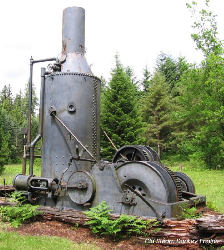
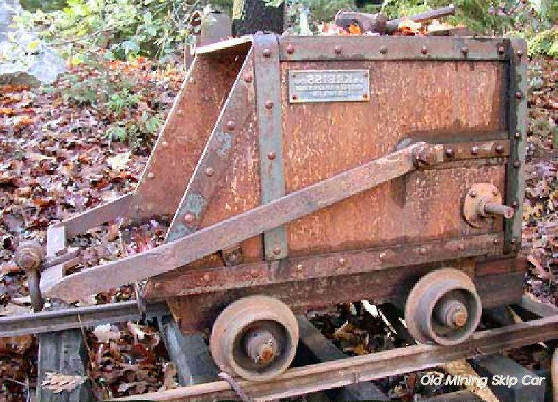
These sheds also contained equipment for use by the mine. The equipment mine cars (three different sizes), donkey engines, skips (several sizes down to winz buckets), and track pipe (mostly wooden), to survive the action of a big mine. The period from 1904 to the close of World War I was, if one is permitted to scramble a metaphor, the golden age of Copper Hill. The two shafts tapped the main ore body at a depth of 300 to 400 feet. A line of ore wagons hauled the output past Forest Home to a rail siding near Clay Station. The old bridge was very lightly used, and then its floor was ripped up, leaving only a plank for foot traffic. As a thing of economics one wonders why the old bridge could not have been beefed up to a point where it could have served to make a hookup with the rail siding at Latrobe, a distance of 5 miles north as against 20 miles to the south. | ||

| ||
|
Information, photographs courtesy of the Amador County Archives, The Historical Marker Database, The Chronicling America Database, and Larry Cenotto, Amador County's Historian CONTACT US
|
||

